Flood Inundation Modelling and Visualization: Application for Natural Flood Management
Published on 24 February 2014 in Climate, water and energy
Introduction
Natural Flood Management (NFM) is generally defined as the alteration, enhancement, restoration or utilisation of natural landscape features and characteristics as a way of reducing flood risk. NFM includes measures such as woodland creation, land management techniques, working within the channel banks (for example, remeandering and woody debris), run off management techniques and coastal NFM measures. NFM measures have started to be considered in the UK flood risk management planning; this was a recommendation in the Pitt review on 2007 floods. In Scotland, the Flood Risk Management Act (Scotland) 2009 is the main policy driver for the implementation of NFM.
Key Points
- Flood inundation models are able to predict where flooding might occur, how severe it might be, and the impact that different mitigation measures might have on flood risk in different situations.
- Model output and results largely depend on the quality of input data and model assumptions (such as inputs from overland flow to a channel). Output should always be checked carefully against scientific evidence, local knowledge, empirical data, industry standards and best practice.
Research Undertaken
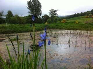
There are currently a range of NFM measures being implemented in Tarland Burn catchment (74 km2), a tributary catchment of River Dee in Aberdeenshire, North East Scotland. The catchment is typical for many agricultural regions of Northeast Scotland, in which the major land uses are arable (25%), plantation forestry (19%), improved and unimproved grassland (36 and 10% respectively), heather moorland (8%) and mixed/broadleaved woodland (2%). The two main settlements are Tarland (26km2) and Aboyne (70km2) which have been flooded as a result of this watercourse in 2000, 2002, 2005, 2006, 2009 and 2010.
We applied a modelling framework to assess the effectiveness of current NFM measures (wetlands, storage ponds and riparian management) and future NFM measures (for example, offline storage areas, tree planting) in Tarland. Previous studies found that there was a potential for online and offline storage ponds as NFM measures in this catchment1. We considered a series of small storage ponds (2000-5000 m3) to reduce flood risk in Tarland. We developed a modelling framework by using a combination of one-dimensional (ISIS) and two-dimensional (Tuflow) flood models. As we have not recorded extreme flood events yet, we have used Flood Estimation Handbook (FEH) methodology to develop rainfall profiles of different return periods as input to these models and this will be compared with empirical data and local knowledge later in the project.
We found that the models predicted the flood inundation reasonably well using the FEH approach. With the model output, potential vulnerable areas have been identified and flood inundation maps have been developed for a range of flow conditions. We also found that storage ponds (~5,000 m3) may be effective for smaller flow events at the sub-catchment scale of Tarland, potentially with a return period up to 1 in 10 year. The modelling output can be improved as our empirical database grows and as we collect local knowledge.
We also have developed an innovative way of visualization of flood maps using three-dimensional landscape models. These models are generated within Visual Nature Studio (VNS) from GIS information including terrain, aerial photography, maps (including historical data), trees and crops, roads, rivers and streams, buildings, people, animals and atmospheric data. The models can be viewed by stakeholders through a variety of media including the James Hutton Institute’s Virtual Landscape Theatre (VLT, an immersive interactive viewing environment), video clips and print.
The visualizations allow us to better view and understand the extent of flood inundation in combination with other characteristics such as land cover. Outputs have also been integrated into local Environmental Virtual Observatory flooding tool, part of the NERC funded Environmental Virtual Observatory pilot project.
Policy Implications
- Identification of potentially vulnerable areas and production of flood inundation maps are the key components of local flood risk management plan set out by the Flood Risk Management (Scotland) Act 2009. Flood inundation maps driven by empirical data and local knowledge coupled with effective visualization should be developed to fully understand the flood mechanism and potential risks.
- Policies on the implementation of NFM are being promoted in Scotland which requires mapping of “natural features” (section 19) and an assessment of possible contribution of alteration, enhancement or restoration of natural features and characteristics to further reduce flood risk (section 20). Application of robust and practical hydrological and hydraulic modelling tools driven by field evidence will allow us to assess the effectiveness of NFM measures to reduce flood risk at increasing catchment scales. This includes effective communication of the associated uncertainties.
References
1. Aberdeenshire Council, 2007. Tarland burn catchment flood relief scheme, Aberdeenshire, Initial Environmental Assessment Report. Aberdeenshire Council.
Authors
Sohan Ghimire, James Hutton Institute sohan.ghimire@hutton.ac.uk
Mark Wilkinson, James Hutton Institute mark.wilkinson@hutton.ac.uk
Gillian Donaldson-Selby, James Hutton Institute Gillian.Donaldson-Selby@hutton.ac.uk